Imray G1 Řecko a Peloponés
| Námořní mapy | Středozemní moře | Řecko, Turecko
mapa Středozemního moře Řecko a Pelopones
Zařazení:
Námořní mapy |
Středozemní moře |
Řecko, Turecko
Značka: Imray
Dostupnost: dotaz na dostupnost
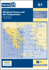
Imray G1 Řecko a Peloponés
Imray G1 Mainland Greece and the Peloponnisos
mapa Středozemního moře
Řecko a Pelopones
Scale: 1:729,000 WGS 84
Plans included:
Vórion Stenón Kérkiras (1:70 000)
Ríon – Andírrion Bridge (1:30 000)
Approaches to Pátras (1:15 000)
On this 2017 edition the latest firing practice areas are included. The chart has been re-schemed. The plan of Órmos Falírou has been removed and plans of Vórion Stenón Kérkiras, Ríon – Andírrion Bridge and Approaches to Pátras are included. The chart specification has been improved to show coloured light flashes. There has been general updating throughout.
Kategorie
Partneři
![]()