Imray G35 Dodecanese and Coast of Turkey
| Námořní mapy | Středozemní moře | Řecko, Turecko
mapy středozemního moře, egejské moře mapy, mapa pobřeží Turecka
Zařazení:
Námořní mapy |
Středozemní moře |
Řecko, Turecko
Značka: Imray
Dostupnost: dotaz na dostupnost
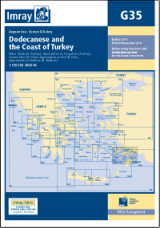
Imray G35 Dodecanese and Coast of Turkey
mapy středozemního moře, egejské moře mapy, mapa pobřeží Turecka
Scale: 1:190,000 WGS 84
Imray
Edition date 2016
Printed and corrected to April 2016
Plans included:
Approaches to Kós (Nísos Kós) (1:20 000)
Approaches to Turgutreis (Turkey) (1:100 000)
Bodrum (Turkey) (1:20 000)
Approaches to Ródhos (Nísos Ródhos) (1:30 000)
Órmos Sími (Nísos Sími) (1:40 000)
On this 2016 edition the latest depth surveys have been applied where available. Seaplane operating and landing areas are now shown. Completed works at Rhodes marina is also shown. General updating throughout.
Kategorie
Partneři
![]()