Imray
| Imray
Zvolte podkategorii:
- Suffolk and Essex Coasts
- Kent and Sussex Coasts
- Jadran
- Itálie západ
- Akční slevy
- Španělsko, Portugalsko
- Středozemní moře
- English Channel, France, Atlantic Spain, Portugal
- Ostrovy Atlantiku
- Francie
- Solent
- Virgin Islands
- Španělsko, Francie
- Skotsko, Irsko, Irské moře
- Devon and Dorset Coasts
- Puerto Rico
- Řecko, Turecko
- West Country
- Leeward Islands
- Mull and Adjacent Coasts
- Atlantik a Karibik
- Severní moře
- Venezuela
- Windward Islands
- Firth of Clyde
- Channel Islands
- Irsko
- Indický oceán a Rudé moře
- Bristol Channel
- Skotsko
- North and West Wales
- Nezařazené
- Velká Británie
- Německo
- Pacifik, Austrálie, Nový Zéland, Asie
- Anglie a Irsko
- Ostatní
- Mapy SHOM
- Holandsko
- Francie a Belgie
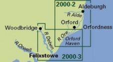
Suffolk and Essex Coasts
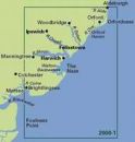
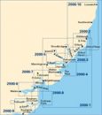

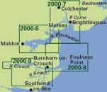
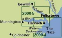 Imray 2000.4 Harwich Approaches and Walton Backwaters
Imray 2000.4 Harwich Approaches and Walton Backwaters


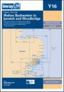 Imray Y16 Walton Backwaters to Ipswich and Woodbridge
Imray Y16 Walton Backwaters to Ipswich and Woodbridge
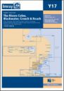 Imray Y17 The Rivers Colne, Blackwater, Crouch and Roach
Imray Y17 The Rivers Colne, Blackwater, Crouch and Roach
Kent and Sussex Coasts
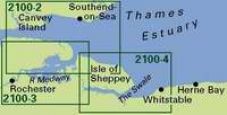
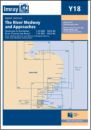 Imray Y18 The River Medway and Approaches
Sheerness to Rochester and River Thames Sea Reach
595,- Kč
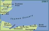
 Imray 2100 The Kent and Sussex Coasts chart pack
Imray 2100 The Kent and Sussex Coasts chart pack


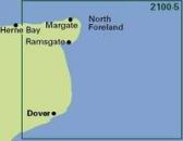
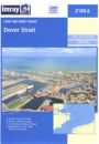
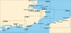 Imray 2100.7 Dover to Beachy Head and Boulogne
Imray 2100.7 Dover to Beachy Head and Boulogne

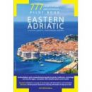
Jadran
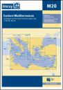 Imray M20 mapa Východní Středomoří
mapa středozemního moře Sardinie, Kypr, Port Said, Černé moře
840,- Kč
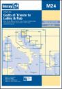 Imray M24 mapa Jaderské moře: Golfo di Trieste to Losinj and Rab
mapa středozemního moře, mapa Jaderské moře
840,- Kč
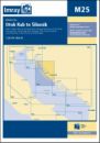 Imray M25 mapa Jaderské moře: Otok Rab to Sibenik
mapa středozemní moře, mapa Jaderské moře
840,- Kč
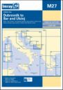 Imray M27 mapa Jaderské moře: Dubrovnik to Bar and Ulcinj
mapa středozemní moře, mapa Jaderské moře
840,- Kč
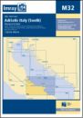
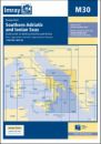 Imray M30 mapa Jih Jaderského moře a Jónské moře
mapa Středozemního moře, Jaderské moře a Jónské moře Dubrovnik to Kerkira (Corfu) and Sicilia
840,- Kč
Itálie západ
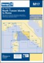 Imray M17 Severní Toskánské ostrovy a Řím
mapa středozemního moře, Ligurské a Tyrhénské moře
840,- Kč

 Imray M47 Liparské ostrovy
mapa středozemnímo moře, Tyrhénské moře, Liparské (Eolské) ostrovy
840,- Kč
Akční slevy
Nebylo nalezeno žádné zboží.
Španělsko, Portugalsko

Středozemní moře
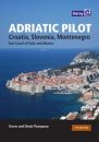 Adriatic Pilot
Croatia, Slovenia, Montenegro, East Coast of Italy, Albania. Bby: T & D Thompson
1 440,- Kč
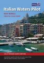 Italian Waters Pilot
Edition 8th (2011). Italian Waters Pilot is the only guide for yachtsmen in English that covers the coasts of the Tyrrhenian Sea, Sardinia, Sicily, the Ionian 'heel' and Malta in one volume.
1 350,- Kč
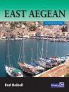
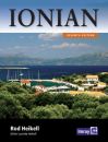 R. Heikell: Ionian
Corfu, Levkas, Cephalonia, Zakinthos and the coast to Finakounda. By Rod Heikell
949,- Kč
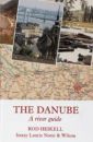
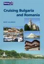 Cruising Bulgaria and Romania
Cruising Bulgaria and Romania aims to encourage many more yachtsmen to discover the pleasures of cruising the Lower Danube and the western Black Sea, to visit the ports and harbours (both antique and modern) and the miles of unspoilt beaches in these fascinating areas.
910,- Kč
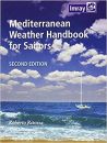 Mediterranean Weather Handbook for Sailors
Mediterranean Weather Handbook for Sailors' is an indispensable reference providing a general understanding of the various phenomena concurring to determine weather in the Mediterranean as well as useful forecasting aids.
649,- Kč
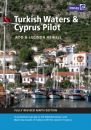 Turkish Waters and Cyprus Pilot
Jachtařský průvodce Turecka s ostrovy a Kypru. Obsahuje více než 450 detailů přístavů a kotvišť.
1 349,- Kč
English Channel, France, Atlantic Spain, Portugal

Ostrovy Atlantiku
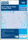 Imray Chart 100 North Atlantic Ocean Passage Chart
Imray Chart 100 North Atlantic Ocean Passage Chart


Francie
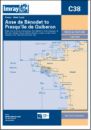 Imray C38 Anse de Bénodet to Presqu'ile de Quiberon
Imray C38 Anse de Bénodet to Presqu'ile de Quiberon

Solent
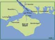
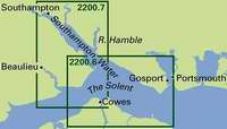
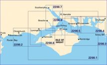 Imray 2200.10 Rivers & Marinas in Southampton Water
Imray 2200.10 Rivers & Marinas in Southampton Water
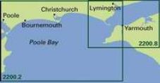 Imray 2200.2 Western Approaches to The Solent
Imray 2200.2 Western Approaches to The Solent
 Imray 2200.3 Eastern Approaches to The Solent
Imray 2200.3 Eastern Approaches to The Solent
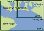
 Imray 2200.4 Chichester and Langstone Harbours
Imray 2200.4 Chichester and Langstone Harbours
 Imray 2200.5 Portsmouth Harbour and Approaches
Imray 2200.5 Portsmouth Harbour and Approaches


Virgin Islands

 Imray Chart 1 Eastern Caribbean General Chart
Imray Chart 1 Eastern Caribbean General Chart
Španělsko, Francie
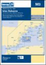 Imray M3 Baleárské ostrovy
mapa Středozemní moře, mapa Baleárské ostrovy Formentera, Ibiza, Mallorca, Menorca
840,- Kč
Skotsko, Irsko, Irské moře
Devon and Dorset Coasts
Imray 2300 Dorset and Devon Coasts Chart Pack
Imray 2300 Dorset and Devon Coasts Chart Pack

 Imray 2300.2 Western Approaches to the Solent
Imray 2300.2 Western Approaches to the Solent
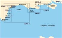
 Imray 2300.3 Poole Harbour to Bill of Portland
Imray 2300.3 Poole Harbour to Bill of Portland


 Imray C5 Bill of Portland to Salcombe Harbour
Imray C5 Bill of Portland to Salcombe Harbour
Puerto Rico
 Imray A11 Bahia de Guanica to Punta Borinquen
Imray A11 Bahia de Guanica to Punta Borinquen
 Imray A131 Isla de Culebra and Isla de Vieques
Imray A131 Isla de Culebra and Isla de Vieques
 Imray A14 San Juan to Isla de Vieques and Isla de Culebra
Imray A14 San Juan to Isla de Vieques and Isla de Culebra
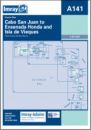 Imray A141 Cabo San Juan to Ensenada Honda and isla de Vieques
Imray A141 Cabo San Juan to Ensenada Honda and isla de Vieques
Řecko, Turecko
 Imray G11 Jónské ostrovy - sever
Mapa Středozemního moře Řecko, Jónské ostrovy sever Nísos Kérkira to Nísos Levkas
860,- Kč
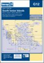 Imray G12 Jónské ostrovy - jih
Mapa Středozemního moře Řecko, Jónské ostrovy jih Nísos Levkas to Nísos Zákinthos
860,- Kč

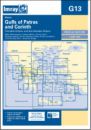 Imray G13 Gulfs of Patras and Corinth
mapa Středozemního moře, Řecko Patraikós Kólpos and Korinthiakós Kólpos
860,- Kč
 Imray G141 Saronikós Kólpos
mapa Středozemního moře, Řecko Corinth Canal to Akra Sounion and Nisos Poros
860,- Kč
 Imray G15 Jižní Peloponés
mapa Středozemního moře Órmos Navarínou to Nísos Kithíra and Ákra Tourkovigla
860,- Kč
 Imray G22 Egejské moře - Severovýchod
mapa Egejské moře - Severovýchod Středozemní moře mapa
860,- Kč
 Imray G27 Nísos Lésvos & the Coast of Turkey
mapy středozemního moře, egejské moře mapy, mapa pobřeží Turecka
860,- Kč
 Imray G28 Nísos Khíos & the Coast of Turkey
mapy středozemního moře, egejské moře mapy, mapa pobřeží Turecka
860,- Kč
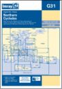 Imray G31 Severní Kyklady
mapy středozemního moře, egejské moře mapy, Řecko, severní Kyklady
860,- Kč
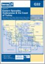 Imray G32 Eastern Sporades, Dodecanese & the Coast of Turkey
mapy středozemního moře, egejské moře mapy, mapa pobřeží Turecka
860,- Kč
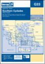 Imray G33 Jižní Kyklady - západ
mapy středozemního moře, egejské moře mapy, Řecko, jižní Kyklady
860,- Kč
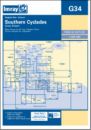 Imray G34 Jižní Kyklady - východ
mapy středozemního moře, egejské moře mapy, Řecko, jižní Kyklady
860,- Kč
 Imray G35 Dodecanese and Coast of Turkey
mapy středozemního moře, egejské moře mapy, mapa pobřeží Turecka
860,- Kč
 Imray G36 Marmaris to Geyikova Adasi
mapy středozemního moře, egejské moře mapy, mapa pobřeží Turecka
860,- Kč
 Imray G39 Nísos Karpathos to Nísos Rhodos
mapa Středozemního moře, mapa Egejské moře, pobřeží Turecka
860,- Kč
 Imray M21 Jižní pobřeží Turecka, Sýrie, Libanon a Kypr
mapa Středozemního moře, mapa Egejské moře, pobřeží Turecka
860,- Kč
 Imray M22 Egypt, Israel, Libanon, Kypr
mapa Středozemního moře, mapa pobřeží Egypta, Israele, Libanonu a Kypru
860,- Kč
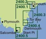
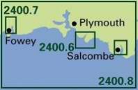
West Country


 Imray 2400.14 Saint Mary's, Tresco and surrounding islands
Imray 2400.14 Saint Mary's, Tresco and surrounding islands


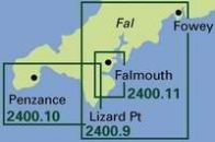
 Imray C7 Falmouth to Isles of Scilly and Trevose Head
Imray C7 Falmouth to Isles of Scilly and Trevose Head
Leeward Islands
 Imray A24 Anguilla, St Martin and St Barthélémy
Imray A24 Anguilla, St Martin and St Barthélémy
 Imray A25 St Eustatius, St Christopher, Nevis, Montserrat and Saba
Imray A25 St Eustatius, St Christopher, Nevis, Montserrat and Saba
 Imray A281 Anchorages in Guadeloupe, Les Saintes and Marie-Galante
Imray A281 Anchorages in Guadeloupe, Les Saintes and Marie-Galante
 Imray A4 Guadeloupe to St Lucia Passage Chart
Imray A4 Guadeloupe to St Lucia Passage Chart
Mull and Adjacent Coasts
Imray 2800 Mull and Adjacent Coasts Chart Pack
Imray 2800 Mull and Adjacent Coasts Chart Pack
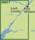
 Imray 2800.1 Crinan to Tobermory and Fort William
Imray 2800.1 Crinan to Tobermory and Fort William
 Imray 2800.3 Cuan Sound to Loch Spelve and Kerrera Sound
Imray 2800.3 Cuan Sound to Loch Spelve and Kerrera Sound
 Imray 2800.4 Oban to Loch Aline and Port Appin
Imray 2800.4 Oban to Loch Aline and Port Appin
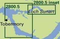 Imray 2800.5 Loch Aline to Tobermory and Loch Sunart
Imray 2800.5 Loch Aline to Tobermory and Loch Sunart
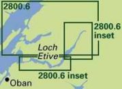 Imray 2800.6 Loch Linnhe South and Loch Creran
Imray 2800.6 Loch Linnhe South and Loch Creran
Atlantik a Karibik

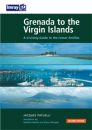 Grenada to the Virgin Islands
This popular book covering the Caribbean from Grenada and Barbados to the Virgin Islands is a translation from Jacques Patuelli's original French version.
1 194,- Kč
Severní moře
 Cruising Guide to Germany and Denmark
Covering the North Sea and Baltic coasts of Germany and Denmark, this guide is a companion to Brian Navin’s North Sea Passage Pilot and Cruising Guide to the Netherlands.
1 400,- Kč
Venezuela
 Imray D10 North coast of Trinidad and Golfo de Paria
Imray D10 North coast of Trinidad and Golfo de Paria
 Imray D12 Carupano to Cumana and Isla de Margarita
Imray D12 Carupano to Cumana and Isla de Margarita
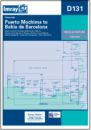 Imray D131 Puerto Mochima to Bahia de Barcelona
Imray D131 Puerto Mochima to Bahia de Barcelona
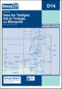 Imray D14 Islas los Testigos, Isla la Tortuga, la Blanquilla
Imray D14 Islas los Testigos, Isla la Tortuga, la Blanquilla
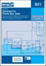
 Imray D23 Punta Aguide to Cabo San Roman and the A, B, C Islands
Imray D23 Punta Aguide to Cabo San Roman and the A, B, C Islands
Windward Islands
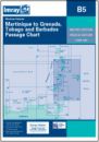 Imray B5 Martinique to Tobago and Barbados Passage Chart
Imray B5 Martinique to Tobago and Barbados Passage Chart
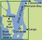
Firth of Clyde
Imray 2900.1 Upper Firth of Clyde and Loch Fyne
Imray 2900.1 Upper Firth of Clyde and Loch Fyne
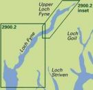 Imray 2900.2 Loch Fyne - Ardrishaig to Inverary
Imray 2900.2 Loch Fyne - Ardrishaig to Inverary
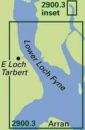 Imray 2900.3 Lower Loch Fyne and Inchmarnock Water
Imray 2900.3 Lower Loch Fyne and Inchmarnock Water
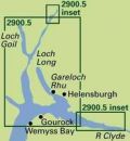
Channel Islands
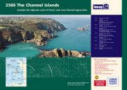
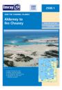
 Imray 2500.10 Approaches to the Channel Islands
Imray 2500.10 Approaches to the Channel Islands


Irsko

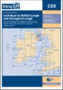 Imray C69 Loch Ryan to Belfast Lough and Strangford Lough
Imray C69 Loch Ryan to Belfast Lough and Strangford Lough
Indický oceán a Rudé moře
Bristol Channel


 Imray 2600.11 Milford Haven and River Cleddau
Imray 2600.11 Milford Haven and River Cleddau

 Imray 2600.4 Approaches to the Bristol Channel
Imray 2600.4 Approaches to the Bristol Channel


Skotsko
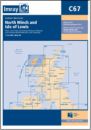
 Imray C66 Mallaig to Rudha Reidh and Outer Hebrides
Imray C66 Mallaig to Rudha Reidh and Outer Hebrides
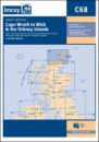 Imray C68 Cape Wrath to Wick and Isle of Lewis
Imray C68 Cape Wrath to Wick and Isle of Lewis
North and West Wales
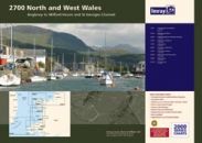


 Imray 2700.3 Southern Anglesey and Lleyn Peninsula
Imray 2700.3 Southern Anglesey and Lleyn Peninsula


Nezařazené
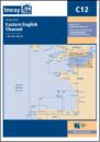 Imray C12 Eastern English Channel Passage Chart
Imray C12 Eastern English Channel Passage Chart
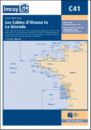
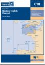 Imray C10 Western English Channel Passage Chart
Imray C10 Western English Channel Passage Chart
 Imray C18 Western Approaches to the English Channel and Biscay
Southern Ireland to Northern Spain
899,- Kč
 Imray C25 Harwich to River Humber and Holland
Imray C25 Harwich to River Humber and Holland
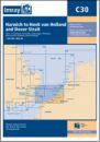 Imray C30 Harwich to Hoek van Holland and Dover Strait
Imray C30 Harwich to Hoek van Holland and Dover Strait
Velká Británie

Německo
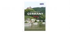 Inland Waterways of Germany
This is the only comprehensive directory to the entire navigable German waterway system available in English.
1 200,- Kč
Pacifik, Austrálie, Nový Zéland, Asie
Charlie's Charts of Polynesia
Imray Charlies Charts - Polynesia, by Charles and Margo Wood
1 560,- Kč

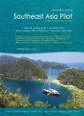 Southeast Asia Pilot
A guide encompassing approximately 600,000 square miles of some of the best cruising grounds in the world.
1 900,- Kč
Anglie a Irsko
 Imray Inland Waterways of Great Britain
The standard reference to the waterways of England, Wales and Scotland has been completely revised.
1 249,- Kč
 Imray Inland Waterways of Ireland
Of all the countries in Europe, Ireland particularly lends itself to exploration by water. It is an island of manageable size with deep-sea loughs cutting far inland, spectacular inland loughs surrounded by mountains, and majestic rivers connected by man-made canals.
1 149,- Kč
 Imray River Thames Book
Including the River Wey, Basingstoke Canal and Kennet and Avon Canal
686,- Kč
 Fearsome Passages
Fearsome Passages is an anthology of his articles previously published in the yachting press. Each covers a channel or harbour entrance that is notorious for having difficult tide and current conditions.
750,- Kč
 Imray Map of the Inland Waterways of Great Britain
Imray Map of the Inland Waterways of Great Britain
 Imray Map of the Inland Waterways of Scotland
The second edition of Imray's Map of the Inland Waterways of Scotland has been updated.
605,- Kč
Ostatní
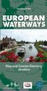 Map of European Waterways
A map and directory designed as a first source of information when planning a trip on the waterways of Europe.
899,- Kč
Mapy SHOM
Nebylo nalezeno žádné zboží.
Holandsko
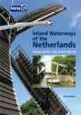 Imray Inland Waterways of the Netherlands
With 6,000km of navigable waterways, the Netherlands offers one of the most extensive yet compact cruising grounds in Europe. This book is a user's guide to the whole network, covering all the mast-up routes and excluding only those waterways which offer less than 3.5m bridge height.
1 200,- Kč
Francie a Belgie
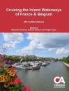 Cruising the Inland Waterways of France & Belgium
This informative guide to the waterways of France & Belgium is published by the Cruising Association and regularly updated by its members.
936,- Kč
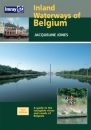 Imray Inland Waterways of Belgium
There has not been a guide in English to the Inland Waterways of Belgium since E E Benest's handbook went out of print in the early 1960's. Jacquelne Jones' new guide provides detailed coverage for anyone interested in this under-rated waterway network.
1 149,- Kč
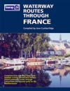
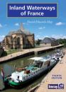 Imray Inland Waterways of France
The standard guide to the French canals and navigable rivers includes maps and distance tables for each waterway, giving the user a general view of the geography of each waterway as well as a detailed cockpit reference.
1 249,- Kč
Kategorie
Partneři
![]()