Imray C27 Firth of Forth
| Námořní mapy | Severozápadní Evropa | Velká Británie | Skotsko
Imray C27 Firth of Forth
Zařazení:
Námořní mapy |
Severozápadní Evropa |
Velká Británie |
Skotsko
Značka: Imray
Dostupnost: dotaz na dostupnost
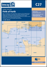
Imray C27 Firth of Forth
Scale: 1:75,000 WGS 84
Imray
Plans included:
St Andrews (1:7,500)
Crail (1:7,500)
Anstruther (1:7,500)
St Monans (1:7,500)
Elie (1:10,000)
Methil Docks (1:11,000)
Pettycur & Kinghorn (1:17,500)
Inchkeith (1:25,000)
Burntisland (1:20,000)
Aberdour (1:12,500)
Inchcolm (1:15,000)
Dalgety Bay (1:15,000)
Inverkeithing (1:15,000)
North Queensferry & Port Edgar (1:20,000)
Charlestown & Limekilns (1:15,000)
Grangemouth and Entrance to River Carron (1:17,500)
Granton (1:12,500)
Fisherrow (1:12,500)
North Berwick (1:7,500)
Dunbar (1:7,500)
Continuation to Forth and Clyde Canal Entrance (1:17,500)
On this 2013 edition, the latest known depths have been applied throughout the main chart and on the plans of Grangemouth and Granton. Harbour developments are shown at Granton.
Kategorie
Partneři
![]()